
2D1N Y Ty Lung Po - The Land of Cloud Tour


-
地図を表示する
完売
体験できること
Y Ty belongs to Bat Xat District of Lao Cai province. It is the border commune in Northwest Vietnam where has border with China. The best time to travel Y Ty is from September to April next year to get the wonderful scenery of cloudy cover surrounding mountains, hills. While August to September is the best time to get the golden scenery of terrace rice fields. Also, Y Ty is the land where offers you to discover the unique cultures of Ha Nhi minority people Come and join with you friends and family and exclusive offers!

Have a chance to enjoy "cloud hunting" on this land


Upstream of the Red River, we take you to the Lung Po Flagpole. Admire the scenery and take photos of this place

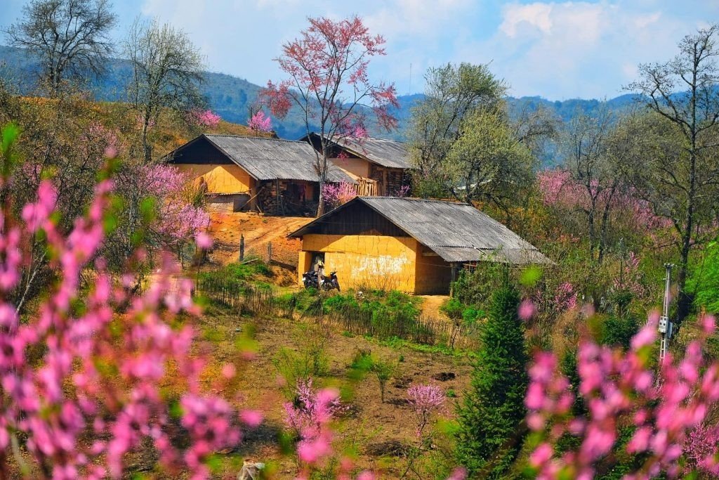
The clay houses (Trinh Tuong House) lying quietly in the misty clouds of the highland make a beautiful picture of nature


Conquering Ngai Thau - the land of "thousands of clouds" at an altitude of more than 2000m


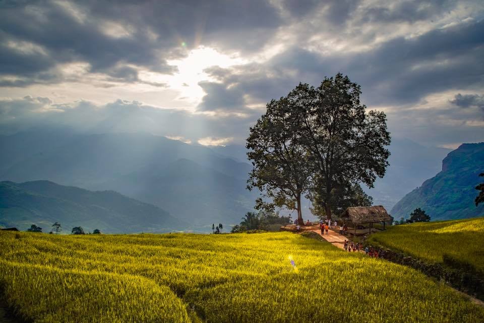
Along the way, you also admire the terraced fields stretching along the mountainside, brilliantly yellow in the ripe rice season
連絡先、施設、サービス言語など
可能であればレビューを残してください。

場所の詳細

 Facebook
 Instagram
 Youtube
